

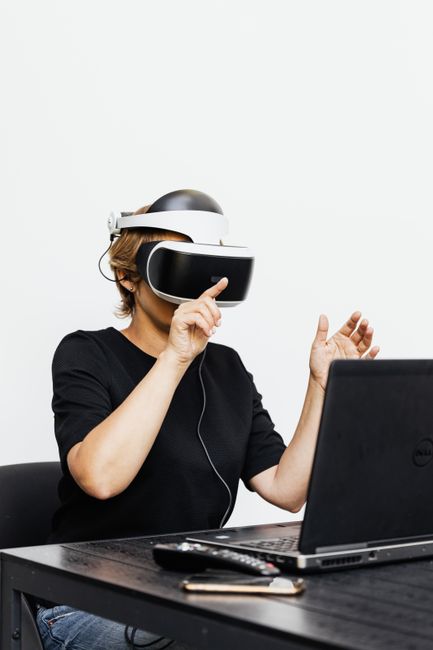
The world of land sales is changing faster than most could have imagined. At USA Land Group, we’re in the trenches of this evolution, watching as virtual reality (VR) tours redefine the way buyers, brokers, and investors experience raw land across the 3,142 counties we operate in. While photos and Google Maps once felt revolutionary, we’re now seeing tech bring the field—literally—into your living room. Whether you’re an out-of-state investor, a broker aiming to work smarter, or a buyer needing more confidence from afar, VR has the potential to make an abstract patch of earth feel personal and tangible, no matter where you are.
Why the Remote Land Market Demanded Change
Unlike residential sales, buying vacant land has always been a leap of faith. Buyers often struggle to visualize terrain, access routes, tree cover, views—making due diligence feel risky from a distance. Brokers and agents, meanwhile, juggle endless emails, questions, and time in their cars, showing sites to uncertain clients. Investors need to review multiple parcels quickly and efficiently, often in markets far from home. In these scenarios, traditional tools (like satellite maps or photos) can disappoint. VR, however, bridges these gaps in some powerful ways.
The Essence of a VR Tour for Vacant Land: More Than Just a Gimmick
Let’s unpack what matters for our world—recreational and residential land:
- True Spatial Awareness: VR lets prospects experience rolling terrain, elevation changes, and even the feeling of standing at key points (like the property corner or hilltop) without stepping foot onsite.
- Immediate Context: Virtual overlays can show boundary lines, access routes, nearby amenities, and zoning zones. At USA Land Group, our focus remains on transparency so buyers understand both potential and limitations on day one.
- Compared to Traditional Photos: Static images capture just one angle. VR tours allow you to “walk” the property, look around, and explore features like proximity to water sources or buildable spots—boosting buyer confidence.

How VR Helps Buyers: Confidence Before Commitment
- Remote Exploration: Prospective buyers anywhere in the U.S. can now experience a piece of land at their own pace, on any device—reducing travel costs and risk.
- Visualizing Possibility: Instead of guessing about mountain views, tree density, or potential build sites, buyers can “stand” in the space—helping narrow choices or fall in love with a parcel sooner.
- Due Diligence: It’s easier to verify access, review terrain, and spot potential red flags like seasonal water features—giving more confidence to move forward or, equally important, pass before wasting time and money.
How VR Empowers Brokers & Agents
For brokers and agents, integrating VR becomes a competitive advantage, reshaping workflows and expanding reach:
- Multiply Your Showings: Host virtual open houses or send tours to multiple buyers without ever leaving your desk. This is especially powerful for high-volume brokers covering vast rural territories.
- Refined Prequalification: Brokers can let leads pre-tour listings remotely, ensuring that in-person visits are serious. This is how we help sellers reduce “tire-kicker” traffic and increase the odds of offers from each actual showing.
- Collaboration: Quickly gather feedback from developers, engineers, or investors, all viewing the same virtual experience. Planning meetings become more focused—and everyone saves time.
Why Investors Are Embracing Virtual Reality in Land Acquisition
Investors who focus on land (whether flipping for appreciation or holding for long-term development) make decisions fast. VR tours allow for:
- Rapid Portfolio Review: Review dozens of parcels in different states or regions, filtering to only the highest-potential deals for further on-site review.
- Transparent Stakeholder Communication: Investors can loop in partners or lenders with links to VR tours, reducing hesitation and disagreements.
- Pre-Development Analysis: Simulate how access improvements, clearing, or minor grading might change the property’s usability—helping to model ROI before a single dollar is spent.
What Makes a Great VR Land Tour? Our Perspective
Not all VR experiences are created equal. Our team is passionate about what makes a tour worth your time:
- High Resolution and 360° Access: Quality matters. Low-res tours, grainy images, or restricted views create doubt. We always advocate for clarity—showing not just the best, but the real, of every property.
- On-the-Ground Sensation: Where possible, tours should incorporate sound, dynamic sunlight, and real-life movement to give a sense of time and place.
- Integrated Data Layers: Overlaying floodplain lines, property boundaries, or zoning highlights is a must for informed decisions.
- Easy Cross-Device Use: Whether on a phone, laptop, or VR headset, accessibility should be seamless, giving every buyer, broker, or investor the same clear impression.

Overcoming Common Concerns—Is VR Trustworthy?
- Can VR tours be misleading? Yes, in the wrong hands. That’s why our standard is transparency: no selective angles, all the good and the not-so-good up front.
- What about real access issues? VR won’t replace a survey or boots-on-the-ground due diligence—but it dramatically narrows your focus and reduces unpleasant surprises down the road.
- Is special equipment required? The best tours play on any device. Full immersion’s possible with a headset, but a laptop or phone is plenty for most land buyers.
Practical Tips: How to Get the Most Out of VR Land Tours
- Ask for Full-Dimensional Coverage: Don’t settle for a 360 of just one spot—request multiple waypoints or a true “walk-through” if possible (ask your agent, or us, if available).
- Overlay Reference Data: Always compare the tour with surveys, floodplain maps, and county data.
- Take Notes & Screenshots: Annotate what you notice for follow-up discussions—especially if you’re comparing multiple properties.
- Share with Trusted Partners: VR tours aren’t just for buyers; pull in your architect, builder, or attorney for early input.
The Future: Where VR & Remote Land Buying Go Next
The technology evolves daily—soon, VR tours could integrate with drone flyovers, soil analysis overlays, or real-time traffic simulations. As land specialists, we see these tools not as replacements for on-site review but as force multipliers: they save us (and you) wasted trips, avoid dead-end deals, and drive informed, confident action.
At the end of the day, the VR revolution is helping democratize access to rural and recreational land across America, putting more information in your hands, wherever you are. At USA Land Group, we’re excited about these breakthroughs because they align with what we’ve always believed: knowledge empowers buyers, turns sellers into better marketers, and allows investors to move with clarity and conviction.

Your Next Step: Explore Us Virtually or Reach Out
If you’re ready to experience what’s possible in remote land sales, we invite you to discover how we work—and how virtual reality and next-generation tech can shape your next purchase or sale. Start exploring or connect with us today to see how a smarter, more transparent remote land deal feels, from first tour to final handshake.


