

When it comes to buying vacant land in the U.S., whether for residential or recreational purposes, assessment is always the first huge hurdle. For years, this meant either walking a property—sometimes miles in rough terrain—or relying on outdated maps and satellite imagery that told only half the story. Today, the game is changing quickly. At USA Land Group, operating across all 3,142 U.S. counties, we’re not just keeping up—we’re leaning in, leveraging technology where it can make the biggest difference for land buyers, sellers, and investors. One of the most transformative tools we’ve seen? Drones. Here’s a detailed look at how drones are revolutionizing vacant land assessment and why this matters whether you’re a buyer, investor, or just land-curious.
1. True-to-Life Land Visualization—From Anywhere
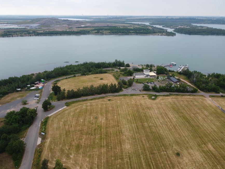
High-resolution drone imagery eliminates the need for multiple onsite visits. Our clients get sweeping, current aerial photos and video to review a parcel’s true topography, vegetation, water features, and even access points—right from their laptop or phone. The difference between an overhead satellite image and a low-flying, high-definition drone pass is stark:
- See the slope in real detail: No more guessing about whether a parcel is buildable or will require major grading.
- Spot obstacles: Large rocks, mature trees, or hidden water bodies come into view, which is critical for planning or risk reduction.
- Assess privacy and surroundings: You can see exactly what’s next door, even when trees are leafed out, or when streams are flooding.
2. Measuring Parcel Boundaries and Acreage Accuracy
Traditional land surveys are expensive and can take weeks to book, especially in rural counties (where most raw land is found). While drones don’t replace a legal property survey for closing, they can be used in the early stages to:
- Overlay boundary visuals on drone footage, giving a precise sense of where a property’s limits lie, relative to fences or landmarks.
- Calculate rough acreage with geo-referenced aerial images.
- Spot encroachments or unrecorded easements that might otherwise be missed.
This info is invaluable for buyers and investors looking to do due diligence without expensive initial outlays.
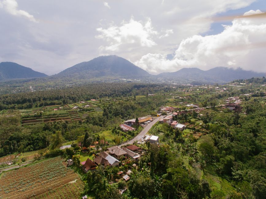
3. Understanding Access, Utilities, and Neighboring Use
One of the most common surprises in vacant land investment? Realizing that an advertised access road is overgrown, impassable, or even non-existent. Drones help us:
- Trace the actual condition of access roads and trails—are they gravel, paved, washed out, or blocked? Footage answers instantly.
- Identify proximity to power lines, utility infrastructure, or wells (visible by surface features).
- Assess usage and surroundings; for example, you might see nearby agriculture, industrial activity, or new developments over the treeline that wouldn’t show on an old listing photo.

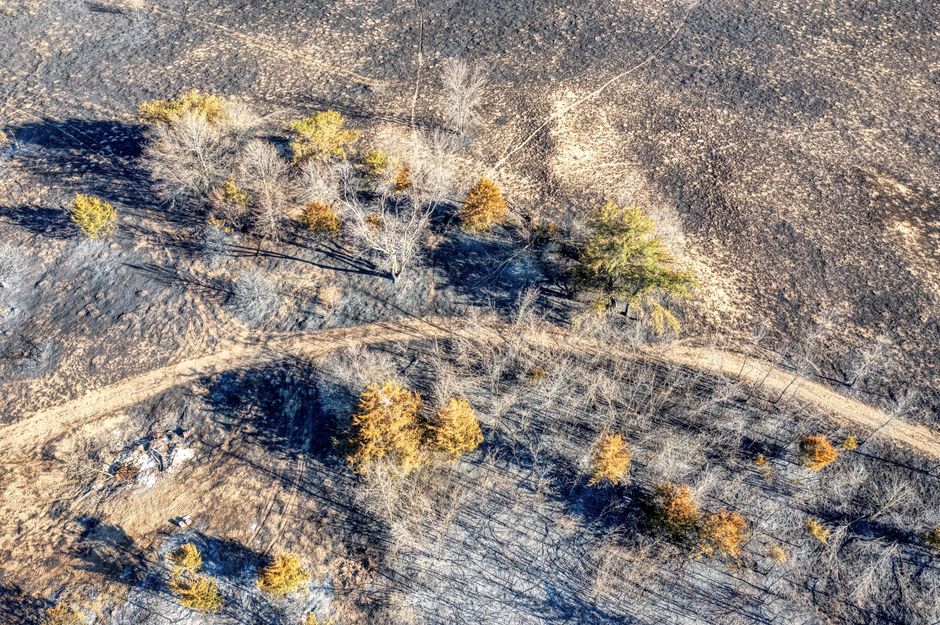
4. Environmental and Risk Assessment
Drones allow us—and thus you—to literally get a bird’s-eye view of things you can’t see from ground level. This is critical in the due diligence process:
- Drainage patterns: Is the land prone to flooding after rain? Are there seasonal creeks or low spots that might accumulate water?
- Land disturbance: Look for evidence of recent logging, erosion, or illegal dumping—which can affect value or usability.
- Vegetation health: Spot signs of fire (scorched areas), disease, or invasive species that could impact future plans.
We can often identify—and mitigate—risks before you ever invest substantial time or money, reducing the odds of post-purchase headaches.

5. Faster, Smarter Decision-Making & Marketing
The raw land market moves quick, especially as remote work and outdoor recreation trends fuel demand. Drones help us and our clients in several big ways:
- Speed: You get answers—sometimes within hours—about land features, boundaries, and access, even from across the country.
- Remote Collaboration: Share drone footage easily with partners, investors, family, or your real estate agent for rapid input, without everyone traveling onsite.
- Enhanced Listings: Sellers benefit from drone video tours, boosting buyer interest and trust with transparency that’s simply not possible with ground-level images alone.
In short, drones reduce uncertainty and speed up the go/no-go decision so you can stay agile in a competitive landscape.

What Does This Mean for You?
At USA Land Group, we’re all about empowering our clients—buyers, investors, or sellers—to make confident decisions with as much data as possible, as fast as possible. The drone revolution in land assessment aligns perfectly with our focus: maximizing ROI, limiting risk, and bringing total transparency to every deal in all 3,142 counties nationwide.
Whether you’re eyeing your first recreational parcel or a larger development project, tapping into drone technology (with the right experienced partners) means you sidestep guesswork and see the land as it really is.
If you’re interested in learning more about how we use drones and other tech to help clients buy and sell land smarter, explore more of our resources or connect with us at USA Land Group. Land is America’s backbone—we help you see it clearly, wherever you are.


